


Short Hikes on the Buckeye Trail . . .
Cuyahoga Valley: Red Lock-Boston Loop
Eagle Project by Phil Aquila; assisted by Paul Aquila
Distance: 8 miles
Hiking time: 4 hours
Description: Cuyahoga Valley National Park is a 33,000 acre park that encompasses the Cuyahoga River and parts of the Erie Canal, along with many historical buildings and sites. The name Cuyahoga, which means “crooked river”, comes from the Mohawk Indians who once inhabited the area. From hills and thick forests to streams and fields, Cuyahoga Valley has a diverse collection of views that can be enjoyed from any of its 100 miles of trails.
Directions: On I-271 take exit 18B and take OH- 8 south. Take a right onto Highland Rd. Turn left onto Olde 8 rd. Turn left onto W Highland rd. Parking lot will be on right.
Parking & restrooms: Parking is available at the Red Lock trailhead. Restrooms at parking lot and in Boston Mills.
Maps: https://www.nps.gov/cuva/planyourvisit/maps.htm
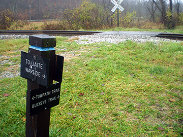
Begin at the Red Lock parking lot. Take the Towpath trail a short distance south, and then take a right on Highland Rd. After crossing a bridge the trailhead for the Buckeye Trail will be on the left.
The trail winds through tall grass, and crosses straight over the Cuyahoga Scenic Railroad.
A short distance from the tracks will be the Riverview Rd-Snowville Rd. intersection. Cross Riverview and continue onto Snowville Rd. The trail marker for Buckeye Trail (South) is on the left. At the time of writing the trail marker is missing or hard to spot. It will be on the left, across from the Buckeye Trail (North) trail marker.
The trail starts with a steep hill, and then continues along the heavily wooded ridge. The trail merges with a service road and then goes under some high tension wires, at which point there will be a view of the river valley below.
The trail crosses a quiet road (Columbia Rd) and goes downhill through a stand of numerous types of oak trees. It will then come to a quick moving, medium sized stream. You will need to find a place to ford it as there is no bridge, and crossing may be dangerous if there was recent rain.
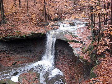
About two miles from the stream you will come upon the scenic Blue Hen Falls. The water falls fifteen feet over the clay-like ledge before continuing to the Cuyahoga. The trail goes through the parking lot for the falls and across Boston Mills Rd. It then curves toward I-271 and then back to Boston Mills. It will follow the road for a short distance before turning back toward the woods. (Be sure to watch for the blue blazes during this segment). You will climb up a ridge, and then the trail will head downwards into the Village of Boston.
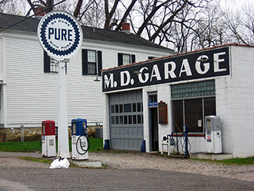
Head east on Boston Mills Rd. through the town and across the river. In town is a general store with snacks and a visitor center, and many other old buildings that offer a chance to explore. When you come to the Towpath you will want to take a left to the path north towards Red Lock.
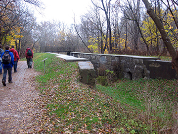
The Towpath is flat and a relatively easy hike. It follows the Cuyahoga River and what used to be the Erie Canal. You will pass some of the remaining locks of the canal, as well as the Jaite Paper Mill. There is also the Stanford House, will offers campsites if you wish to do an extended hike through the park (Check with the park for more information). There is also abundant wildlife around this area, be sure to keep an eye out for bald eagles. After 2 miles you will arrive back at the Red Lock parking lot.
For more information on the park: http://www.nps.gov/cuva/index.htm
Stanford House: http://www.nps.gov/cuva/planyourvisit/lodging.htm