

BTA Trustee Board NominationsJune 15 — July 15, 2025
The Buckeye Trail Association is excited to announce that we are seeking nominations for our Board of Trustees! A Trustee must be at least age 18, a member in good standing of the Buckeye Trail Association, and must maintain their membership throughout the term of office. We are seeking nominations from June 15 - July 15 2025. You can declare or ask questions by emailing Lori Luken at
If you are seeking to declare as a candidate, please also include a 250-word bio about yourself when emailing Lori. Our candidates' announcement and election process update will be coming soon!
Buckeye TrailFest 2025 ‐ Registration has Opened!

The 12th annual Buckeye TrailFest is scheduled for September 5‐7, 2025 at Maumee Bay State Park on the shore of Lake Erie.
Visit the TrailFest 2025 website for all the info about programs, lodging and camping, hikes, Friday Fun Day, meals, registration, the silent auction, the annual meeting, and to learn about sponsorship opportunities.
All Sections Trail Info
NOTE:Please be aware that along the length of the Buckeye Trail, many parks, trail managers, historic and public locations, etc., maintain hours or days of operation which limit access to their facilities. BEFORE you head out to hike, check the web site for the location you intend to visit for any restrictions. Please respect their stated access policies.
National Park Service Feasability Study
The National Park Service is conducting a feasability study to determine the status of the Buckeye Trail to become a National Scenic Trail. Although the opportunity to offer comments concerning the study has concluded, community members and stakeholders can still review the feasibility study process. Please visit https://parkplanning.nps.gov/buckeyetrailfs for details.
Ohio Department Of Natural Resources (ODNR) Announcement
ODNR announces a new resource, Buckeye Trail Anywhere, a free guide to the Buckeye Trail. The guide takes learners of all ages on a journey through scenic trail towns, rich geography, diverse ecosystems, and fascinating historical landmarks while staying physically active through customizable activities. Please visit www.ohiodnr.gov/buckeyetrailanywhere to download the guide.
If you need the Buckeye Trail Section Tracker Map discussed in the document, you may download it here.
Birding on the BT
Several years ago the BTA provided a pamphlet to assist avid birders with finding good locations along the BT to view a variety of birds. Ohio is part of a large migratory route with many species pausing here on their trek. The pamphlet is updated and once again available as a download. Birds are here throughout the year. This is a great time to plan your hikes.
Downlaod the updated BTA eBirding pamphlet.

Buckeye Trail 50 + 5 Challenge
The 50+5 Challenge was created in celebration of the Ohio Legislature’s Year of the Trails and the 50th Anniversary of the National Trails System Act in 2018. In 2024, the 65th Anniversary of the Buckeye Trail and Buckeye Trail Association, we again invite Ohioans to challenge themselves to hike 50 miles on Ohio's 1,400+ mile BT and give back 5 volunteer hours to the trail we love. Even though 2024 is over, the challenge continues.
50+5 Hiker-Volunteers that complete the challenge and register their volunteer hours will receive a congratulatory packet including a certificate of completion, a 50 mile hiking patch, and a Buckeye Trail Association 5 hour volunteer patch to commemorate their accomplishment.
All the details are on our 50+5 Challenge page.

Hike Join Volunteer Give Initiative
There is a lot of great news coming for the BT just around the bend, but we need your support today to help us continue our important work, for you, and for all Buckeyes. If you can, please take that next step and donate today to support the Buckeye Trail Association. Above All, Thank You for Hiking!
Visit the Events page for hiking information.
Visit the Membership page for membership benefits information.
Click on this Join link to join the BTA by credit card online.
Visit the Get Involved page for information on volunteer opportunities.
Visit our Donate page for additional information.
Download the latest donation appeal letter .
Click on this Donate link to make a donation by credit card online.
BT 101 Video
The BT 101 Video is now available as a YouTube video. You may see the video at this link: https://youtu.be/1z_6bSX2Hdw
Strategic Plan
BTA's Strategic Plan has been in the development stages since 2017 and the now completed plan called BTA 2025 will provide guidance to take the BTA forward for the next 5 years. The Executive Summary of this plan is now available BTA 2025 for download. Note: It is a large file.
The BTA's Board of Trustees is currently working on the Strategic Plan for the next 5 years.
Trailblazer Archive - DID YOU KNOW?
Some of our past Trailblazer issues are available online, including the very first issue published in 1968! We've come along ways in 60 years! Check them out on our Trailblazer page
Volunteer Opportunites . . .
Are you looking for ways to help? Our goal is to find you a volunteer position worthy of your unique talents, and one that excites and inspires you. For more information on available opportunities, contact our Volunteer Coordinator at
or register in the Volunteer Portal and you will be notified of opportunities. Remember that signing up in the software does not sign you up for any job, it just allows you to see opportunities. Register as a volunteer now!
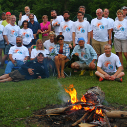
Celebrating Volunteer Accomplishments . . .
We thank you all of our remarkable volunteers. Some of this work is perhaps not as glamorous as making a trail from a path in the woods, but it is rewarding and vital to the success of the Buckeye Trail. THANKS.