Shawnee Section
- Overview
- Akron
- Bedford
- Belle Valley
- Bowerston
- Burton
- Caesar Creek
- Defiance
- Delphos
- Loveland
- Massillon
- Medina
- Mogadore
- New Straitsville
- Norwalk
- Old Man's Cave
- Pemberville
- Road Fork
- St. Marys
- Scioto Trail
- Shawnee
- Sinking Spring
- Stockport
- Troy
- West Union
- Whipple
- Williamsburg

Trail Description
Peach Mountain Road.
K. Fix
Supervisor: OPEN
•
55.7 Total Miles / 26.4 Off Road Miles (47.4%)
Map Publication Date: January 2020
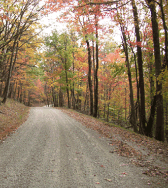
Welcome to one of the most remote sections of the trail. Facilities near the trail are very sparse. The terrain is unglaciated, highly dissected plateau which is generally wooded. The highest points that the trail will visit are in this section. The trail begins at the entrance to Davis Memorial State Nature Preserve, located near Peebles in Adams County, at an elevation of 738 ft. After meandering through this Preserve, the trail returns to roads that meander up Peach Mountain past the GE Jet Engine Test Station, visit Mineral Springs and Wamsley in the drainage of the Scioto Brush Creek. The trail makes a brief visit on footpath to property that is mostly within the BTA Ballinger Preserve. Back on roads, the trail enters Scioto County. There, it enters Shawnee State Forest where it leaves road and joins the Shawnee Backpack Trail that crosses not only Shawnee State Forest but also Shawnee State Park. In time, the trail joins the Shawnee Wilderness Trail to visit the only designated wilderness within Ohio. Within the wilderness, the trail returns to Adams County. The trail leaves the wilderness on an equestrian trail which ends on road. The final treat is several miles of footpath on properties owned by The Nature Conservancy. The section ends at the intersection of that footpath and West Fork Rd, located between Lynx and Rome in Adams County, at an elevation of 904 ft. Between these points, the trail climbs over 9800 ft and descends a similar amount.


Trail Alerts
- (6/8/2022) ODNR has announced that the Southern Ohio Forest Rally 2022 will take place June 7-11, 2022. Roads will be closed in the Shawnee State Forest on June 10th. This closure directly affects the Buckeye Trail from Point 12 to Point 13, for FR 6, Copper Head Rd. The road will reopen the following day. Follow this link for a map provided by ODNR identifying the closed Forest Roads.
- (4/7/2019)This Alert announces that blazing throughout the Shawnee Section is generally poor.
Because the Shawnee Section is presently without a Section Supervisor or much supporting maintenance staff, the section is poorly blazed. Besides the blazing issues, many parts of the trail that are off road are blocked by dead fall. If you wish to volunteer to help maintain this section, contact the BTA Office in Shawnee, OH.
Map Updates
- (6/2/2022) This Shawnee map update identifies a change to the trail between Points 13 and 14 and adds 0.2 mi to the BT. The BTA follows the Shawnee Backpack Trail which has recently changed to follow the ridgetops in this area rather than the valleys. The trail is well marked. In addition, the BT is working to ensure the trail is blue blazed, but that effort may not be complete.
Note: Since the total length of the trail in the Shawnee Section increases by 0.2 mi to 55.9 mi, the CW and CCW mileages need to change as follows. From Point 14 to Point 25, add 0.2 mi to the CW direction. From Point 13 back to Point 1 add the 0.2 mi to the CCW direction.
In addition, the off-road mileage changes to 26.6 mi. - (8/16/2019) A major change in the routing of the trail through properties owned by The Nature Conservancy has favorably affected the route of the trail through the western end of the Shawnee Section and the eastern end of the West Union Section. The log below reflects these changes. The log specifically updates both the Shawnee Section Map Edition of December 2011 and the West Union Section Map Edition of August 2012.
About the Shawnee Section map, the most significant change is that the Section no longer reaches old point 29 (Sunshine Ridge Rd (T156) at Long Lick Rd (T181)). However, because there have been a number of little changes, these little changes have been incorporated west from Point 25 to Point 28.
The biggest changes are in what is best referred to, at least for now, as changes to the West Union Section. For the West Union changes visit the West Union Section page.
The following log represents the changes to the Shawnee map only.CW CCW Pt 41.4
N4.1
SE25 Buckhorn Ridge Bridle Trail at Sunshine Ridge Rd (F17/T202B)
Note: The Bypass Trail from Wamsley rejoins the BT here. Join Sunshine Ridge Rd that climbs N. After just 350', the trail reaches, arguably, the highest point it reaches anywhere in the state - 1276'. Continue to meander generally NW on Sunshine Ridge Rd.43.6
SW1.9
SE26 Sunshine Ridge Rd (F17/T202B) at Carter Run Rd (T173)
A cemetery is located at this intersection. Meander generally W on Sunshine Ridge Rd (now T202A); after 0.9 mi, pass a cemetery. The churches that were associated with the cemeteries seem to be gone.45.1
W0.4
N27 Sunshine Ridge Rd (T202) at Lower Twin Creek Rd (C4)
Meander generally W on Sunshine Ridge Rd that now seems to be C4.45.5
W0.0
N28 Sunshine Ridge Rd (C4/T156) at Slate Fork Rd (C4)
Continue generally W on Sunshine Ridge Rd, now designated T156D.
After 0.26 mi (Location: 38.71612°N, -83.33181°W), exit Sunshine Ridge Rd onto a footpath; head generally W on a gradual descent. Soon, pass through a Mountain Laurel patch. After 0.35 mi, join an old road briefly (75’). Continue descent. After 0.12 mi, ford a stream. (Bad water. Do not consume!) Almost immediately, ford a second stream (potable after purification); soon turn NW. After 0.12 mi, join Johnson Run Rd in the middle of a turn marked with a wide spot on the E side of the road. Head SW briefly (60'). Exit the road W across a bridge over Johnson Run; begin a gradual ascent. After 0.7 mi, cross primitive Reel Ridge Rd (T289, Location: 38.721658°N, 83.342169°W). Very soon, turn parallel to road. For the next 0.5 mi or so, climb slightly to a high ridge. After 1.1 mi, ford an intermittent stream; begin steeper descent.3.2
W66.3
SEA Footpath at Moon Hollow Trailhead (C, P)
Location: N 38.73361, W 83.35263. If you liked cowboy western music during the late 40's through the early 60's, you probably have heard of Cowboy Copas, Oklahoma Cowboy or The Waltz King of the Grand Ole Opry. Those sobriquets were adopted by a Lloyd Estel Copas who was born in this hollow on July 15, 1913. Among other accomplishments, he was the first to record and popularize Tennessee Waltz.
NOTE: Parking at any time is restricted to 4 vehicles. In addition, any vehicle left overnight must display a valid parking permit in the windshield. Exit the trailhead W onto Moon Hollow Rd (T415, 100'). Follow the road S for about 50'. Exit the road W across a bridge over a tributary to Blue Creek. Follow footpath SW across field behind barn and through a fence (Location: N 38.73269, W 83.35341, 350'). Continue generally W on footpath upslope. Ford a stream after 0.14 mi. After 0.6 mi on a ridge, pass a Carsonite Marker (Location: N 38.73390, W 83.35715) that marks the spur trail to the Moon Hollow campsite. Continue along the ridge with occasional views. After 0.8 mi, join Sunshine Ridge Rd (T156C, Location: N 38.72616, W 83.36442) and head W.4.9
NW64.6
EB Sunshine Ridge Rd (T156C) at Blue Creek Rd (C18)
Continue on Sunshine Ridge Rd, now NW, with a new designation, T156B.5.5
S64.0
E2 Sunshine Ridge Rd at Morel Hollow Rd (T312A)
This is Point 2 of West Union. Continue with the map updates on the West Union Section page. - (10/21/2018) This Trail Change applies to the current Shawnee Section Map, the one that shows December 2011 on its front cover. The change applies to all of the text following Pt 9. However, changes to the physical trail begin with the sixth sentence which begins, “After 0.8 mi at a driveway (38.81572°N, 83.27246°W), . . . .”
The change describes new footpath between the driveway and Pt 10 whose title has also changed.CW CCW Pt 12.3
SE34.3
NW9 SR 348 at Mt Unger Rd (T160) in Wamsley
Wamsley was founded in 1864 by the Rev William Wamsley. Exit SR 348 SSE onto Mt Unger Rd (opposite C. U. Chapel). After 0.3 mi, pass Bracken Ridge Rd (T161) that diverges E up hill. Continue SE into Groundhog Hollow. Later, climb more steeply on this very primitive Mt Unger Rd as it continues on its meandering way SE. After 0.8 mi at a driveway (38.81572°N, 83.27246°W), exit road S onto a footpath located between the road and the driveway. Climb gradually through Groundhog Hollow on this meandering path. After 0.3 mi, change direction from NW to SE at a switchback. After 0.2 mi, pass a small, brown shed (C) that is marked with a BTA decal. Turn E across an open field.14.0
E32.6
W10 Two-Track at Mt Unger Rd (T160) and an unsigned Dirt Road (T163
Follow the unsigned, dirt road.
Continue with the current Shawnee Section Map beginning with the information about the counties under Pt 10. In addition, add 0.2 mile to all CW distances greater than Pt 11 and also to all CCW distances less than Pt 9.
Note that camping is still available near the brown shed even though the trail now passes it. Leave no trace! Details are described in your current Shawnee map.
- (11/05/2015) If you have a copy of the Shawnee Section map, edition of December 2011, the following corrections probably should be added to your map. Look at the first line of the material in fine print on the bottom of the back cover of the map. If the copyright date reads 2011, please make the following changes: Under Pt 2, the line that reads "shaded pasture and then heads N across" should read "shaded pasture and then heads S across". And, under the same point, six lines down, the line that reads "please follow BT along fences around E edge of the field" should read "please follow BT along fences around W edge of the field".
Section Blogs
- (1/18/24) Shawnee Section Blog - Provided by Victoria Livingston, BTA hiker. The Buckeye Trail provides a primitive experience for hikers as they enter the wilderness of Shawnee State Forest and The Edge of Appalachia. Take a few tips from our experience with mud, blowdowns, rutted roads, and leaves obscuring the trail. Follow Victoria on her "Walk on the Wild Side Shawnee Wilderness hike"
- (1/18/24) Shawnee Section Blog - Provided by Victoria Livingston, BTA hiker. Shawnee provides rugged terrain for hikers to train for tough hikes. Stay overnight in the plush, historic Shawnee State Lodge or camp along the stream. Follow Victoria on her adventure.
- (1/18/24) Shawnee Section Blog - Provided by Victoria Livingston, BTA hiker. Victoria's husband Dave likes to camp because it's cheap, whereas she'd prefer a B&B with a gourmet breakfast and a comfy bed with memory foam. At the Buckeye Trailfest, she agreed to camp for one night. We endured a long, strange night at camp. What was that scream? Follow Victoria and Dave on their mis-adventure in hiking.
- (1/18/24) Shawnee Section Blog - Provided by Victoria Livingston, BTA hiker. Baby Boomer’s Guide to Best and Worst Backpack Trails in southeastern Ohio details the pros and cons of each as well as helpful tips. (Shawnee is among the trails and camps mentioned). View Victoria and husband Dave's list of the best and worst backpack trails in southeastern Ohio.