Buckeye Trail Fest2025
HIKES
Saturday Hikes
**Important Information** All Hikes will meet with the hike leader at the Snack Bar and Ice Cream Shop located near the front desk of the Lodge. Please be sure to sign up for your hikes at the TrailFest Registration table located by the lodge's front desk on Friday and on the 2nd floor outside the conference rooms on Saturday. Each hike will have its own sign-up sheet!
 Inland Lake Trail:
Hike Leader: TBD
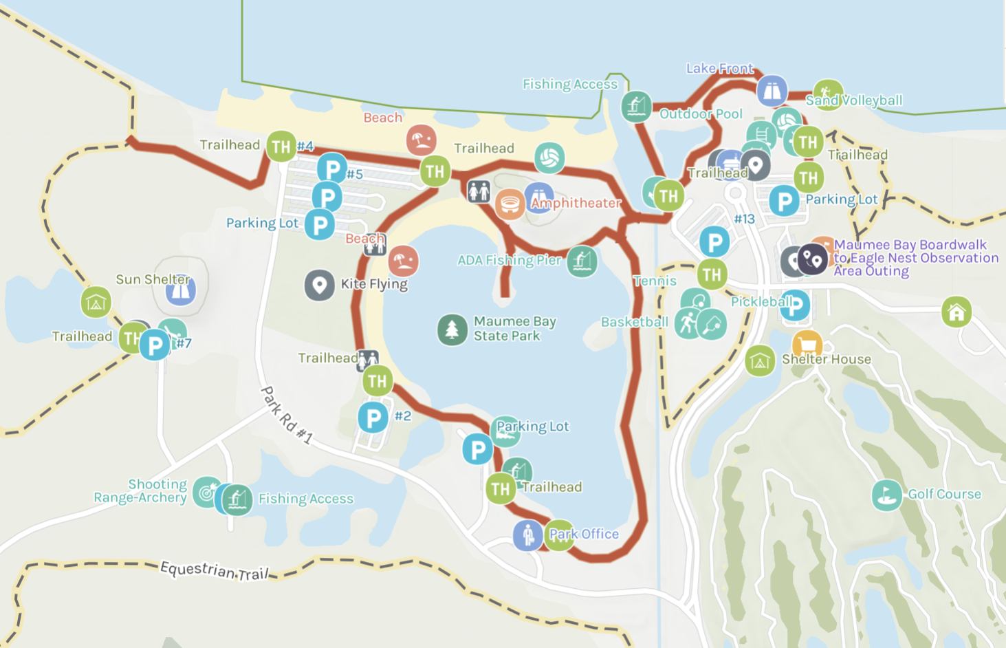
Description: This is the Inland Lake section of the Bike Path. The Bike Path is a paved asphalt trail that travels almost five miles throughout the park. While on the trail, riders will travel along the shores of Lake Erie, past the lodge, and through the rental cabins. This trail also connects with the City of Oregon, Ohio's bike trail, allowing for several more miles of biking. Bike rentals are available at the campground office and the Maumee Bay Lodge and Conference Center.
Hike Length: 4.8 mi loop
Time: 8:45am AND 1:30pm.
 Boardwalk Trail:
Hike Leader: TBD
Description: The Boardwalk Trail is a wooden trail that travels and transitions through an Oak Savanah-type dense forested area into a Lake Erie coastal wetland. The trail can be traversed with strollers and wheelchairs. This loop-style trail also has an elevated observation tower located in the wetland area.
Hike Length: 3.2 mi Out and Back and ADA Accessible
Time: 9:45am AND 2:30pm.
 Storybook Trail:
Hike Leader: TBD
Description: A natural‐style trail with a storybook to read throughout. Milkweed, Virginia Creeper, and other butterfly host plants are scattered along the trail. Look for native pollinators while walking this easy, half-mile trail in a wet meadow. Frogs, deer, red-wing blackbirds, and tree swallows are commonly spotted. This is an easy loop hike and is family friendly.
Hike Length: 0.5 mi loop
Time: 10:45am AND 3:30pm.
Optional Hikes
While this year's TrailFest isn't directly on the Buckeye Trail, just 16 miles south—about a 25 minute drive, attendees will find the Pemberville section of the Buckeye Trail in the town of Woodville. Embracing the hiking community, Woodville welcomes the use of all the town’s facilities and local parking. The Lake Plains Chapter has created three suggested hikes that attendees may enjoy at their leisure.
The Short and Sweet Hike: Description: This hike will start at Point 15 of the official BTA Pemberville Section Map. Starting in the city of Woodville, “43469” allows hikers to utilize all the city's facilities and local parking. You will travel northeast on primarily road sections to the city of Elmore, stopping at the North Coast Inland Trail (NCIT) parking lot. This is Point 17 of the Pemberville Map, totaling your hike at 4.7 miles.
The Afternoon Multipurpose Trail Hike: Description: This hike will start at the North Coast Inland Trail (NCIT) Trailhead in Elmore, “43416”, Pemberville Point 17. You will be traveling southeast through beautiful farmland along the multipurpose trail provided by the NCIT. Hoping to one day link Toledo to Cleveland, the NCIT is a trail conservation organization and a Buckeye Trail Association partner. Your final Stop will be on the edge of Fremont at the trailhead parking lot. This is Point 20 of the Pemberville Map, totaling your hike at 10.6 miles.
The Pemberville Day Hike: Description: This hike combines both hikes listed above. We suggest starting at Point 15 and completing the road portion first. Then stop in Elmore for lunch, Point 17, and continue to Fremont at Point 20. If you choose this hike, you will have completed a nice portion of the Pemberville Map! This hike will total you at 15.3 miles.
Please remember to BE SAFE on your hike. These are just suggestions for local hikes. If you need more information or want to make your own hike, please be sure to pick up an official Buckeye Trail Association Trail map at Buckeye Trail Maps & Guides.
If you encounter any problems while visiting this site, please contact our webmaster at .
Copyright 2025 by the Buckeye Trail Association, all Rights Reserved